warnings updated: Friday, November 06, 2026, 7:18 am PST
NWS San Diego Forecast Discussion – Synopsis
Issued 427 AM PST Fri Nov 6 2026
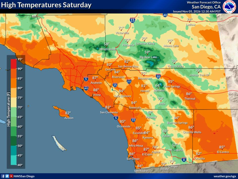
Warm and dry through early next week. Weak to moderate offshore flow today and Saturday will weaken for Sunday through Wednesday. A slow cooling trend begins Monday, with more substantial cooling and increasing precipitation chances late next week.
Covers extreme southwestern California, including Orange, San Diego, western Riverside and southwestern San Bernardino counties.
Offshore winds help bring much warmer weather this weekend. Coastal areas may even be warmer than some of the inland locations. High temperatures for the coasts and valleys will range from near 10 degrees above normal to as much as 20 degrees above normal.
Data Courtesy of San Diego Weather Forecast Office
Almanac information is for the Palm Springs Airport and is provided by the National Weather Service.
High83°normal98° record (1991)
Low57°normal36° record (1936)
Sunrise6:10am
Sunset4:50pm
Moonrise3:40am
Moonset3:10pm
Illumination13%
Evaporative Cooler Effectiveness by City
Thousand Palms
Outside Temp65°F
Dew Point41°F
Est. Output55°F
Updated: Nov 6, 7:24 AM PST
It's already a comfortable 65°F outside — running the cooler isn't needed.
Estimated output is 55°F — air may come out uncomfortably cool.
Palm Desert (Hwy 111 & El Paseo)
Outside Temp69°F
Dew Point42°F
Est. Output57°F
Updated: Nov 6, 7:15 AM PST
It's already a comfortable 69°F outside — running the cooler isn't needed.
Estimated output is 57°F — air may come out uncomfortably cool.
Palm Springs Airport
Outside Temp71°F
Dew Point32°F
Est. Output56°F
Updated: Nov 6, 6:53 AM PST
It's already a comfortable 71°F outside — running the cooler isn't needed.
Estimated output is 56°F — air may come out uncomfortably cool.
Thermal Airport
Outside Temp66°F
Dew Point37°F
Est. Output54°F
Updated: Nov 6, 6:52 AM PST
It's already a comfortable 66°F outside — running the cooler isn't needed.
Estimated output is 54°F — air may come out uncomfortably cool.
How to Read This
Score
0–100, based on the wet-bulb depression — how much cooler the air could get versus the actual outside temperature. Drier air means more room to cool, so a bigger gap scores higher.
Wet-Bulb Depression
The gap between the outside (dry-bulb) temperature and the wet-bulb temperature — the coolest evaporation alone could get the air. A bigger gap means drier air and more room for the cooler to work with.
Estimated(Est.) Output
The approximate temperature of the air coming out of the cooler, estimated by cooling the outside temperature most of the way toward the wet-bulb temperature.
Efficiency
These numbers assume 80% saturation efficiency — typical for a well-maintained direct (single-stage) evaporative cooler.
Lower dew point + higher temp = better cooling
(This guide generally will work for misting systems also)